hartleyfamily.uk - The HARTLEY Surname - Place Names
hartleyfamilyorguk believes that the surname HARTLEY comes from the Anglo-Saxon HEORT-LEA and is derived from Germanic Mother Earth Goddess HERTHA, Goddess of Hunting [see HARTLEY Name Page]
The
earliest known recording of the Place Name HARTLEY is in THE DOMESDAY BOOK
The Domesday Book was commissioned in December 1085 by William the Conqueror,
the Norman King who invaded England in 1066. The first draft was completed in
August 1086 and contained records for 13,418 settlements in the English counties
south of the rivers Ribble and Tees [the border with Scotland at the time].
HARTLEY was called in Domesday [1086] ERCLEI and in the Textus
Roffensis [1125] HERDEI.
The Saxon 'E' was pronounced as our 'A' and the sound of the 'C' against 'L'
is not unlike that of 'T' and 'L' so maybe the name should have been written
'ARTLEI' not 'ERCLEI' ? In the case of Hartley, near Cranbrook,
the Norman scribe wrote 'ARCLEI', a half-way compromise ?
So 'ERCLEI' or 'ARCLEI' is likely the Norman version of the Saxon
'HEORTLEA', named after the Mother Earth Goddess, HERTHA.
In
some places it looks like the name changed over time to: HERCLEGA, then
HURTLEGH, HERTELE, HERTELEGH, HERTLEYE [13thC] HURTLEYE [14thC] HERTELEY [16thC]
... eventually HARTLEY.
In other places, HEORUTLEA HERETSLEY HERTELEIGH HERTLEGH HERTLEY HERTLEGE
HERKELEYE HERCLEYE HERDIE HARLEI HERLEI [11thC] HEORTLEA HERTELEY HARELEY HERTLIGH
[13thC] HURTLEGHE HERTLE [14thC] HERTILEE HERTELE HARTELEY
1.
Berkshire Index Hartley ... http://www.domesdaybook.co.uk/berkshire.html
The parish of Shinfield is situated on the left bank of the River Loddon between
Stratfield Mortimer and Earley, and consists of a central ridge of high land
sloping eastwards to the Loddon and westwards towards the Kennet valley. Within
Shinfield are Hartley Dummer [and Hartley Court], Hartley
Amys, Hartley Pellitot, Hartley Battle and Hartley Regis
2.
Hampshire Index Hartley Mauditt Hartley Wespall ... http://www.domesdaybook.co.uk/hampshire.html
Hartley
Wintney is a large parish situated 2 miles north from Winchfield. In the
immediate vicinity of Hazeley Heath, which is partly within Hartley Wintney,
gravel-pits are found. The village of Hartley Row lies on the main road
from Bagshot to Basingstoke. After leaving the village this road leads on past
Hartley Grange. At the time of the Domesday Survey HARTLEY WINTNEY was
probably included in the great royal manor of Odiham, and it is not mentioned
by name until the 12th century, when a priory was founded here.
Hartley Wespall is a parish and small village on the River Loddon situated 6 miles north-east from Basingstoke, separated from the river by a large stretch of common land called Hartley Wood Common. The water-mill called Hartley Mill probably marks the site of the mill which existed in 1086. Hartley House, in the extreme north of the parish, was formerly the rectory house.
3.
Kent Index Hartley, Kent ... http://www.domesdaybook.co.uk/kent.html
There are two Hartleys in Kent, one near Cranbrook, just up from Hastings, and
the other near Longfield, Gravesend. The first has the longest recorded history
of the two, first mentioned in the year 843 as the Saxon village of HEORTATLEAG
[HEORTLEA, named after the Mother Earth Goddess HERTHA] while the
other is not found until the Domesday Book, in which it appears as ERCLEI.
The name comes from Old English HEOROT, a Hart or Stag Deer, here combined with
LEAH field, clearing, where the Mother Earth Goddess HERTHA was worshipped.
In
early Saxon times the western portion of Kent was divided into two lathes or
lands, taking their names from Elesford and Sudton. And these again were sub-divided
into hundreds. For 600 years of Saxon rule the first village of HEORTLEA came
into the lathe of Sudtone and the hundred of Axton.
The
second Hartley contains about twelve hundred acres, part of which is
a large wood, called Hartley Wood, containing one hundred and fifty acres,
at the northern boundary of it; the soil of it is chalky, light, and much covered
with flints. The church stands on the hill, round which there is no village,
though here, and at Hartley Green, about a quarter of a mile northward
from it, there are several stragling houses. The western part of this parish
lies in the valley, called Hartley Bottom, along which the road leads
to Wrotham and Trosley. This place, at the taking the survey of Domesday, was
part of the vast possessions of Odo, the great Bishop of Baieux, and half-brother
to the Conqueror; under the general title of whose lands it is thus described
there. Ralph Fitz Turald holds Erclei of the Bishop of Baieux. It was taxed
at one suling. The arable land is . . . . . In demesne there are 2 carucates
and 9 villeins, with 6 cottagers, having 3 carucates. There are 3 servants,
and wood for the pannage of 10 bogs. The whole manor was worth 3 pounds, and
now 100 shillings; a certain woman held it. In the same record, a little further
on, under the same title of the bishop of 'Baieux's lands, is this entry: Ralph
Fitz Turald bolds Erclei of the Bishop of Baieux. It was taxed at 1 suling.
The arable land is half a carucate, and there are now 30 acres of arable. In
demesne there is 1 carucate and 6 villeins, having half a carucate. There are
12 acres of meadow. In the time of King Edward the Confessor and afterwards,
it was 40 shillings, now 4 pounds. Hunef, held it of earl Harold. On the disgrace
of the Bishop of Baieux, which happened about four years after the taking this
survey, all his lands and possessions became forfeited to the Crown.
THE MANOR OF HARTLEY, soon after the Conqueror's reign, became part of
the possessions of the noble family of Montchensie, one of whom, Warine de Montchensie,
was owner of it in the reign of King John.
4.
Berkshire D-M Hartley Hurlei: Ralph de Mortimer*. Hartley
Court. Hartridge Hurterige: Alfred from William FitzAnsculf. Hartridge Farm.
... http://www.domesdaybook.co.uk/berkshire2.html
*Ralph de Mortemer, Seine-Maritime. Son of Roger. Lord of Wigmore Castle. Received
lands which had been Earl Roger of Hereford's after his rebellion, 1075. Lands
in 13 counties all over the country.
Note the Domesday Book omitted references to Hartley in Dorset and Hartley [de Harcla] in Cumbria.
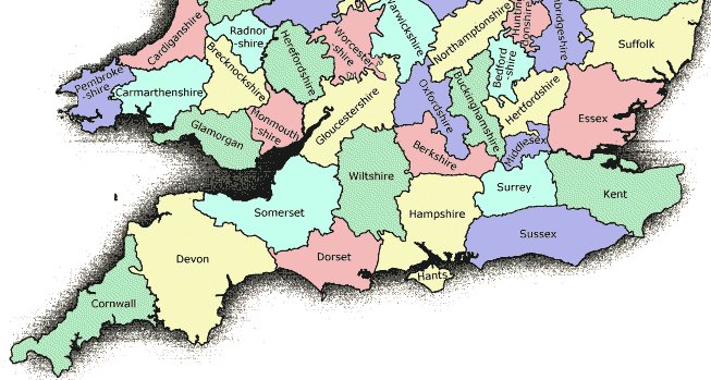
IN THE SOUTH
BERKSHIRE
Hartley
Court Wokingham near Reading, Berkshire Other feature
SU7068 51° 24.6' N 0° 59.2' W map
DEVON
View Larger Map Hartley, City of Plymouth, Devon Village, etc. SX4857 50° 23.8' N 4° 7.9' W ... Hartley is an Edwardian and later, affluent suburb of Plymouth in the county of Devon, England. It is built on higher ground offering views south towards the sea, east into the South Hams, north over Dartmoor and west to Cornwall. It is bisected by the Tavistock Road which also provides ready access to Mutley and the City centre to the south and more immediate access to the A38 Plymouth Parkway, part of the Devon Expressway linking near Exeter to the motorway network. map
East and West Hartley, Near Dartmouth, Devon Other feature SX8052 50° 21.6' N 3° 40.8' W map
DORSET
Hartley Manor Farm Yeovil Dorset Farm ST6406 50° 51.4' N 2° 30.2' W map
ESSEX
Hartley Wood Clacton on Sea Essex Forest or other wooded area TM1517 51° 48.8' N 1° 7.6' E map
Hartley
Wood Farm Clackton on Sea Essex Farm TM1418 51° 49.4' N 1° 6.8' E map
Hartley Wood, Hartley Grove
GLOUCESTERSHIRE
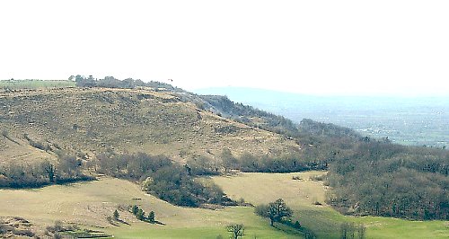 Hartley Hill near Cheltenham, Gloucestershire
Hill SO9518 51° 51.9' N 2° 3.9' W map
Hartley Hill near Cheltenham, Gloucestershire
Hill SO9518 51° 51.9' N 2° 3.9' W map
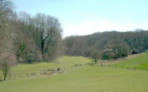 Hartley Bottom and Hartley Wood near Cheltenham, Gloucestershire Forest or
other wooded area SO9517 51° 51.3' N 2° 3.9' W
map
Hartley Bottom and Hartley Wood near Cheltenham, Gloucestershire Forest or
other wooded area SO9517 51° 51.3' N 2° 3.9' W
map
Hartley
Farm near Cheltenham Gloucestershire Farm SO9517 51° 51.3' N 2° 3.9' W map
Hartley
Wood, Hartley Bottom
HAMPSHIRE
View
Larger Map Hartley Mauditt Hampshire Village, etc. SU7436
51° 7.3' N 0° 56.1' W ... Hartley Mauditt is a hamlet in the East Hampshire
district of Hampshire, England. It is 1.2 miles (2km) south of the village of
East Worldham, and 2.6 miles (4.1km) southeast of Alton, just east of the B3006
road. The nearest railway station is 2.5 miles (4km) northwest of the village,
at Alton. The medieval village was much larger but has now shrunk down to the
parish church of St. Leonard and a handful of cottages. map
Hartley Mauditt Village Hampshire Antiquity (non Roman) SU7436 51° 7.3' N 0° 56.1' W ... Hartley Mauditt is a hamlet in the East Hampshire district of Hampshire, England. It is 1.2 miles (2km) south of the village of East Worldham, and 2.6 miles (4.1km) southeast of Alton, just east of the B3006 road. The nearest railway station is 2.5 miles (4km) northwest of the village, at Alton. The medieval village was much larger but has now shrunk down to the parish church of St. Leonard and a handful of cottages. map
Hartley Park near Hartley Maunditt, Hampshire Other feature SU7436 51° 7.3' N 0° 56.1' W map
Hartley
Park Farm near Hartley Mauditt Hampshire Farm SU7335 51° 6.8' N 0° 57.0' W
map
View
Larger Map Hartley Wespall Hampshire Village, etc. SU6958
51° 19.2' N 1° 0.2' W ... Hartley Wespall is a parish and small village
on the River Loddon situated 6 miles north-east from Basingstoke. The altitude
of the parish ranges from about 180 ft. above the Ordnance datum by the River
Loddon in the west to above 290 ft. above the ordnance datum in the extreme
east. The village is grouped round St. Mary's Church in the centre of the parish
on ground about 250 ft. above the ordnance datum, and is separated from the
river by a large stretch of common land called Hartley Wood Common. Hartley
House, in the extreme north of the parish, was formerly the rectory house. map
Hartley House, near Hartley Wespall, Hampshire Other feature SU6959 51° 19.8' N 1° 0.1' W map
View Larger Map Hartley Wintney Hampshire Village, etc. SU7656 51° 18.1' N 0° 54.2' W ... near Hook, Hampshire on the A30 London-Exeter trunk road, it is recorded in the 13th century as Hertleye Wynteneye which means "the clearing in the forest where the deer graze by Winta's island". Winta was a Saxon who owned the island in the marshes where a priory of Cistercian nuns was founded in the middle of the 12th century. map
KENT
Hartley, nr Gravesend, Kent Village, etc. TQ6067 51° 23.0' N 0° 18.4' E ... one Hartley village in Kent lies in the northern side of the North Downs between Sevenoaks, and Dartford/Gravesend. The Domesday Book of 1086 simply tells us that "a woman" used to own Hartley Manor, which was then given to Ralph Fitz Turald. 15 families and 3 slaves lived at Hartley. This had probably increased to around 150 people in the early 1300s, although records are very sparse. In 1377 fifty-three people paid the poll tax, indicative of a population of about 85. map
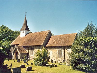 Hartley Parish Church, Kent
Hartley Green near Gravesend, Kent Village, etc. TQ6067 51° 23.0' N 0° 18.4' E map
View Larger Map Hartley, nr Cranbrook, Kent Village, etc. TQ7534 51° 4.9' N 0° 30.4' E ... the other Hartley village in Kent is near Cranbrook, on the A229, just up from Hastings. [see Hartley House, Kent] map
Hartley House, near Cranbrook, Kent Other feature TQ7534 51° 4.9' N 0° 30.4' E map
Hartley Wood Kent Forest or other wooded area TQ6168 51° 23.5' N 0° 19.3' E map
SOMERSET
Hartley Farm Bath and North East Somerset Farm ST7570 51° 25.9' N 2° 21.1'
W map
ELSEWHERE AROUND THE WORLD
View
Larger Map in Australia, North Queensland;
HARTLEY Creek ... location of Hartley's Creek Wildlife Reserve and Crocodile
Farm, near Cairns map
in
Australia, South Australia; HARTLEY is an electoral district of the
House of Assembly in the Australian state of South Australia, near Murray Bridge.
It is named after John Hartley, a public servant responsible for creating much
of South Australia's public education system map
in Australia, New South Wales; HARTLEY is an historical village near
the City of Lithgow, located approximately 150 kilometres west of Sydney. It
is below the western escarpment of the Blue Mountains. It was once a major administrative
centre on the Great Western Highway. It has since fallen into decline, replaced
by other towns that are on the railway line. Hartley was formerly a gold rush
town and had a busy courthouse that was built in 1837. Hartley, Hartley Vale
map
see The
First Australian Hartleys
in Canada, British Columbia; HARTLEY Bay was established and settled
in 1887 after a number of families left Metlakalta, B.C., where they had joined
other Tsimshian people at the utopian mission begund by the lay minister William
Duncan. It is a small First Nations community on the coast of British Columbia.
The village is located at the mouth of Douglas Channel, about 630 kilometres
[390 miles] north of Vancouver and 145 kilometers [90 miles] south of Prince
Rupert. It is an isolated village accessible only by air and water with a population
of 200 map
in Canada, British Columbia; HARTLEY Bay Skeena Queen Charlotte C map
in Canada, Kawartha Lakes; ON, HARTLEY near Peterborough map
in Pennsylvania PA USA; HARTLEY near Bedford, Union County map
in
Texas TX USA; HARTLEY County located at 35°53'4?N 102°23'54?W ... in 2000
its population was 5,537. It is named for Oliver C. Hartley and Rufus K. Hartley,
two early Texas legislators and lawyers map
View
Larger Map in Iowa IA USA; HARTLEY located
at 43°10'55?N 95°28'35?W ... the town of HARTLEY near Sioux Falls was founded
in 1878 map
in West Virginia WV USA; HARTLEY [also known as Brohard] located at 39°2'11?N
81°10'34?W ... an unincorporated community in Ritchie and Wirt counties
map
see
The First
American Hartleys [Part One]
see The
First American Hartleys [Part Two]
see The
First American Hartleys [Part Three]
in former Rhodesia, Africa; HARTLEY located at 18°7'48?S 30°8'9?E the
town near Harare was originally called Old Hartley after Henry Hartley, an early
hunter and explorer but was 34 km east of modern Chegutu. White settlers flocked
to the area because gold was discovered here and the Butterfly and Giant mines
strung up. The settlement was moved to its present location in 1899 and by 1901
the railway reached the settlement. Hartley was proclaimed a village in 1903
and by 1974 Hartley was granted municipality status. Hartley Hill, Hartley Safari
Park map
see The First African Hartleys - 1820 Settlers
please bookmark this website address: hartleyfamily.uk
e-mail enquiries to: william@hartleyfamily.uk