hartleyfamily.uk - The HARTLEY Surname - Place Names
Fact: Looking at English cities, HARTLEYs are most frequently found in; Sheffield, Leeds, Manchester, Blackburn, Bradford, York, Wakefield, Liverpool, Burnley and Oldham.
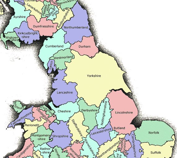
IN THE NORTH
CUMBRIA [CUMBERLAND_WESTMORELAND]
View
Larger Map Hartley Cumbria Village, etc. NY7808 54° 28.3'
N 2° 19.9' W map
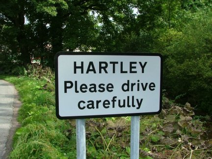 Welcome to ...
 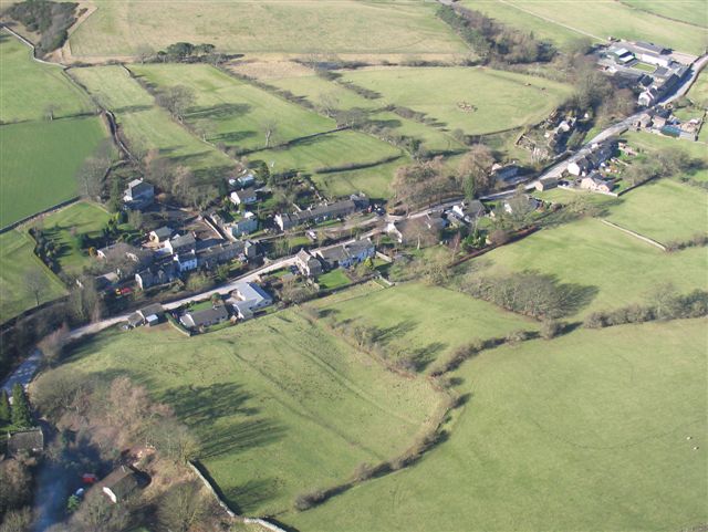 Hartley
Village, Cumbria
Hartley
Village, Cumbria
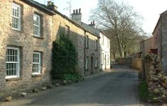 Hartley Cottages
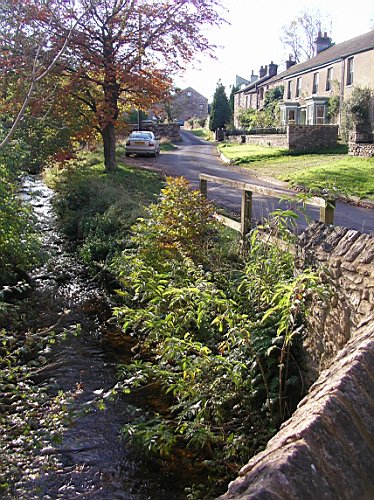 Hartley Beck [thanks to Tom Hartley]
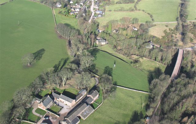
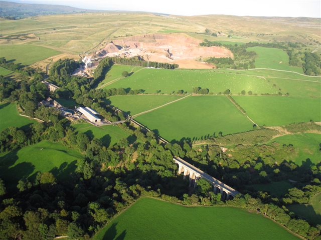 Aerial
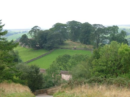
view showing Hartley Quarry [top] with Hartley Railway running diagonally left
to right over Podgill Viaduct. Hartley Castle Hill is wooded [bottom left].
Aerial
view showing Hartley Quarry [top] with Hartley Railway running diagonally left
to right over Podgill Viaduct. Hartley Castle Hill is wooded [bottom left].
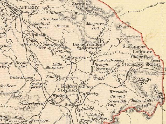 map of local area to Kirkby Stephen and Hartley Village [click
to enlarge].
map of local area to Kirkby Stephen and Hartley Village [click
to enlarge].
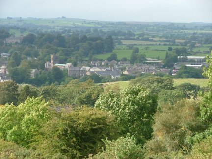 view from Hartley Hills across Kirkby Stephen Ascent is found
by passing through the hamlet of Hartley, just behind Kirkby Stephen. Climb
steeply beside Hartley Quarry until the road end. From here a boggy bridleway
crosses the flank of the fell, to reach the summit of the road pass into Swaledale.
view from Hartley Hills across Kirkby Stephen Ascent is found
by passing through the hamlet of Hartley, just behind Kirkby Stephen. Climb
steeply beside Hartley Quarry until the road end. From here a boggy bridleway
crosses the flank of the fell, to reach the summit of the road pass into Swaledale.
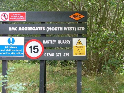 Hartley Quarry, now owned by RMC. The railway link was last used
in 1974. Its still a very busy quarry ... massive lorries now pound the local
lanes.
Hartley Quarry, now owned by RMC. The railway link was last used
in 1974. Its still a very busy quarry ... massive lorries now pound the local
lanes.
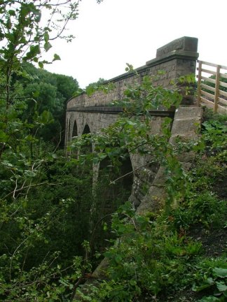 Hartley
Railway, Podgill Viaduct [disused railway now used by Cumbrian walkers]
Hartley
Railway, Podgill Viaduct [disused railway now used by Cumbrian walkers]
View
Larger Map Hartley Manor House [aka Hartley Castle] Cumbria
Other feature NY7808 54° 28.3' N 2° 19.9' W map
 [site of] Hartley Manor House [aka Hartley Castle] near Kirkby Stephen, Cumbria.
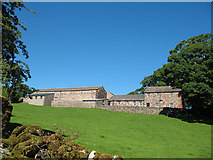 Hartley
Manor House [Castle]
© Copyright Stephen
Craven and licensed for reuse under this Creative
Commons Licence.
Hartley
Manor House [Castle]
© Copyright Stephen
Craven and licensed for reuse under this Creative
Commons Licence.
 [site of] aerial view of Hartley Manor House [aka Hartley Castle]
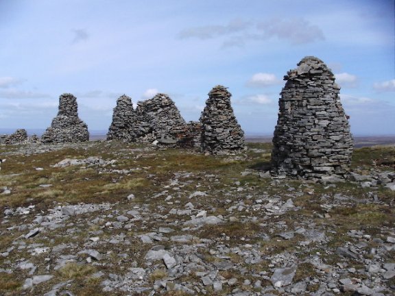 Hartley Fell Cumbria Other feature NY8007 54° 27.7' N 2° 18.0' W ... Nine
Standards Rigg is the summit of Hartley Fell, a fell in the Pennine Hills of
England. It lies near to the boundary between Cumbria and North Yorkshire, a
few miles south-east of the village of Hartley and Kirkby Stephen and approx
700 metres outside the Yorkshire Dales National Park. The name is derived from
a group of standing stones or cairns, the Nine Standards, located near the summit.
[see also Hartley Birkett]. map
Hartley Fell Cumbria Other feature NY8007 54° 27.7' N 2° 18.0' W ... Nine
Standards Rigg is the summit of Hartley Fell, a fell in the Pennine Hills of
England. It lies near to the boundary between Cumbria and North Yorkshire, a
few miles south-east of the village of Hartley and Kirkby Stephen and approx
700 metres outside the Yorkshire Dales National Park. The name is derived from
a group of standing stones or cairns, the Nine Standards, located near the summit.
[see also Hartley Birkett]. map
Hartley
Fold, near the village of Hartley, Cumbria Other feature NY7809 54° 28.8' N
2° 19.9' W map
Hartley Ground, near Broughton-in-Furness, Cumbria Other feature SD2189 54°
17.7' N 3° 12.4' W map
View
Larger Map Hartley's Wife Bowness Lake Windermere Island
SD397968 Lat: 54:21:47N (54.3631) Lon: 2:55:46W (-2.9295) map
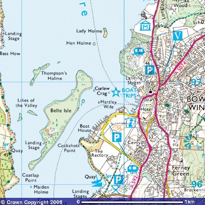 Hartley's Wife Island near Belle Isle, Bowness, Lake Windermere, in the Lake
District, Cumbria [thanks Tom Hartley]
Hartley's Wife Island near Belle Isle, Bowness, Lake Windermere, in the Lake
District, Cumbria [thanks Tom Hartley]
FLINTSHIRE
Hartley Farm Caerwys Flintshire / Sir y Fflint Farm SJ1074 53° 15.6' N 3° 20.5' W map
LANCASHIRE
Hartleys Farm Wigglesworth Lancashire Farm SD7655 53° 59.7' N 2° 21.5' W map
LINCOLNSHIRE
Hartley
Farm Holbeach Lincolnshire Farm TF4031 52° 51.7' N 0° 5.2' E map
NORTHUMBERLAND
View
Larger Map New Hartley Northumberland Village,
NZ3076 55° 4.9' N 1° 31.3' W map
NEW HARTLEYas it is now called is a Mining Village that grew up around the HARTLEY
Colliery Hester Pit which was opened around 1845, with three main streets Cross
Row, Long Row and Double Row, with a Methodist Chapel serving the villagers
Spiritual needs, also the church of St. Michael and All Angels New Hartley,
erected in 1900 by C W Jackson M.A. Vicar.
The village is historically linked to nearby HARTLEY village, which was originally
an Anglo-Saxon settlement. Records show that coal mining began in 1291. A number
of pits were created and exhausted at HARTLEY, before a new pit called Hester
was sunk at a site in between Seaton Sluice and Seaton Delaval. Soon after,
families settled around the new mine, and the village of NEW HARTLEY was created.
Houses were built to the North and West of the pit, in a rough L shape, which
included a Methodist chapel and an Inn, the "Hartley Hastings Arms" and New
Hartley Workmens Club. The New Hartley Pit Disaster occurred in the village
in 1862, killing 204 men and boys. This led to a change in the law and a "best
practice" of building two shafts to a pit throughout Britain and many countries
across the world.
Hartley Northumberland Other feature NZ3375 55° 4.3' N 1° 28.5' W ... is a township and village in Earsdon parish, comprising, along with Seaton Delaval, 4,219 acres. Population in 1801, 1,639; in 1811, 1,872; in 1821, 1,795; in 1831, 1,850; in 1841, 1,911; and in 1851, 1,627 souls. The manor of Hartley was held of the barony of Gaugy, by knight's service in the reign of King John, by Adam de Jesmont, and a mediety of it by Henry Delaval, in the reign of Richard II. The Delaval family afterwards acquired possession of the entire manor, and it is now the property of Lord Hastings. On Bate's Island, nearly opposite Hartley, there was formerly a chapel and hermitage dedicated to the Blessed Virgin. The village of Hartley is situated five miles and a half north of North Shields, and is principally inhabited by colliers, sailors, and fishermen. There is a Primitive Methodist Chapel here, and one belonging to the Wesleyans at Seaton Grove, a hamlet in this township, four and a half miles south of Blyth map
View
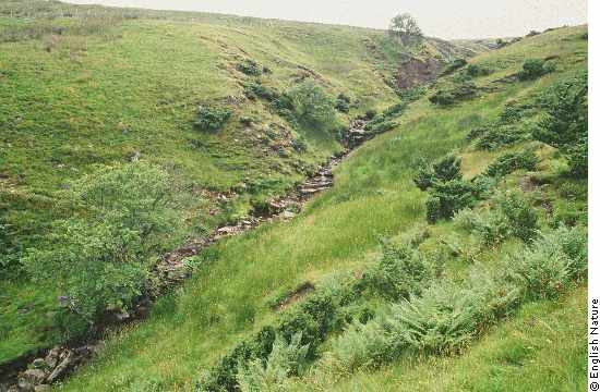
Larger Map Hartley Burn Northumberland Water feature (river,
lake, etc.) NY6559 54° 55.7' N 2° 32.3' W ... Hartleyburn parish lies in
the very south-west corner of Northumberland, on the county boundary with Cumbria.
Much of the parish is the high moorland of Hartleyburn Common with the valley
of the Hartley Burn cutting through the centre and the hamlet of Halton-Lea-Gate
at the foot of the fells. map
Hartley Moor Northumberland Hill NY8148 54° 49.8' N 2° 17.3' W map
Hartleyburn
Common (North Side) Northumberland Other feature NY6461 54° 56.8' N 2° 33.2'
W ... Hartleyburn parish lies in the very south-west corner of Northumberland,
on the county boundary with Cumbria. Much of the parish is the high moorland
of Hartleyburn Common with the valley of the Hartley Burn cutting through the
centre and the hamlet of Halton-Lea-Gate at the foot of the fells. map
Hartleyburn Common (South Side) Northumberland Other feature NY6557 54° 54.7'
N 2° 32.3' W map
 Hartleycleugh Northumberland Other feature NY8048 54° 49.8' N 2° 18.2'
W map
Hartleycleugh Northumberland Other feature NY8048 54° 49.8' N 2° 18.2'
W map
Hartley
West Farm near Hartley Northumberland Farm NZ3375 55° 4.3' N 1° 28.5' W map
STAFFORDSHIRE
View
Larger Map Hartley Green, near Stafford, Staffordshire Village,
etc. SJ9729 52° 51.8' N 2° 2.2' W
map
YORKSHIRE
Hartley Park North Yorkshire Other feature SE0997 54° 22.4' N 1° 51.2' W map
View
Larger Map Hartley Todmorden Calderdale Other feature SD9226
53° 44.1' N 2° 6.8' W map
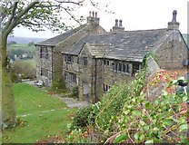
Higher and Lower Hartley, Hartley Royd
 Hartley
Royd Farm
© Copyright David
Martin and licensed for reuse under this Creative
Commons Licence
Hartley
Royd Farm
© Copyright David
Martin and licensed for reuse under this Creative
Commons Licence
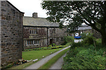
 Hartley
Royd Farm, Buttress Lane, Warley © Copyright Humphrey
Bolton and licensed for reuse under this Creative
Commons Licence.
Hartley
Royd Farm, Buttress Lane, Warley © Copyright Humphrey
Bolton and licensed for reuse under this Creative
Commons Licence.
please bookmark this website address: hartleyfamily.uk
e-mail enquiries to: william@hartleyfamily.uk